Firstly the time: 28 November 2012 if the "blobs" represent an alignment on that day.

It took a while to "lock" it in. The squares just didn't seem to fit and obviously needed to be included in any calculations as well. The "blob" which has been called an unidentified object by many needed to also play its part.
Eventually it clicked, once I remembered that it was a UK crop circle and that if it contained a location, it was likely to be on British soil.
The UK starts at around 50 degrees North, which is a line in the Channel. The vertical circles start with "5", which suggested 50 to me. We are looking at a latitude and longitude, I thought. It didn't seem such a bad idea to put it in the context of a map.

Here's another crop circle and map...
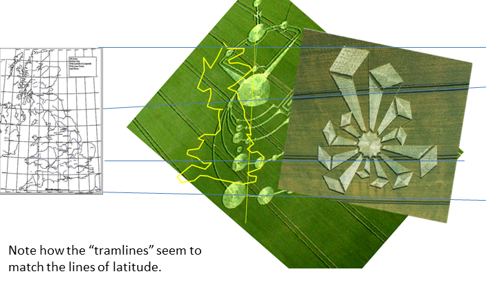
Now why would anyone want to highlight somewhere in the middle of nowhere unless something significant were going to happen?
Here is another "date" formation: 28 November 2012, again.

No comments:
Post a Comment